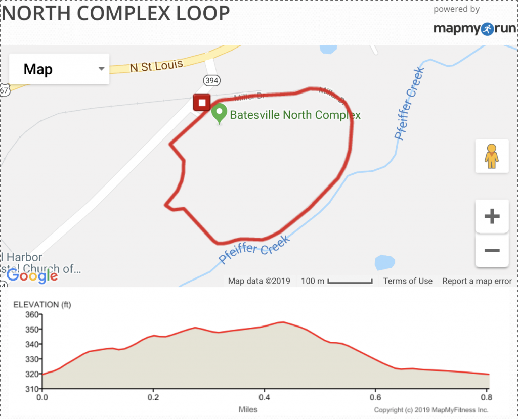
North Complex Loop
.8 Mile Loop
Route Description: The route has a total ascent of 33.3 ft. A short, easy .8 mile loop around the Batesville North Complex of baseball and softball fields. Concrete trail, watch for foul balls!
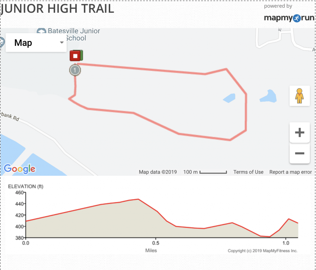
Junior High Trails
1 Mile Loop
Route Description: A 1 mile loop through the wooded area behind the Junior High. The Run has a total ascent of 35.82 ft. Mostly crushed gravel with short portions of grass. Parking in the large lot in front of the Junior High School. No major hazards other than the Spider webs when you’re first through in the mornings. An easy add on to the Batesville Paved Trail route.
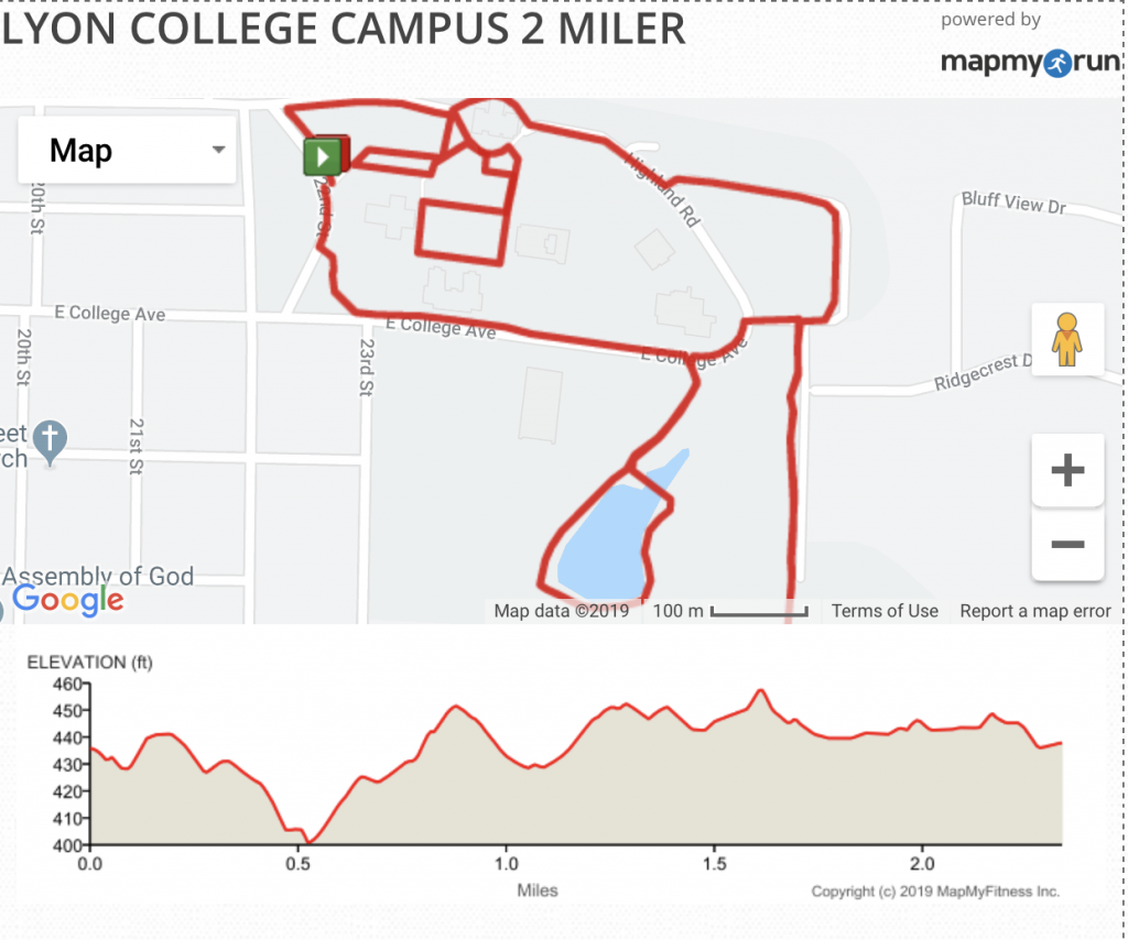
Lyon College Campus 2 Miler Course
Course Description: A mixed surface, relatively flat course. The route has a total ascent of 55.54 ft.
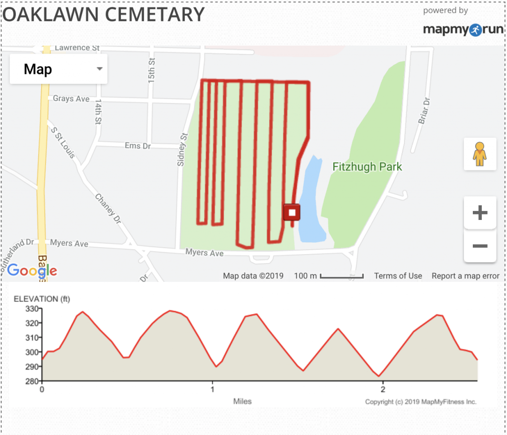
Oaklawn Cemetery
3 Mile Loop
Course Description: The route has a total ascent of 128.32 ft. Oaklawn Cemetery is on the west side of Rowe lake opposite the Batesville Aquatic Center. It offers you the ability to add whatever mileage you wish by simply running additional loops. It is adjacent to the City trails. Favored by walkers, you’ll see almost no traffic here. Some people do walk their dogs in the cemetery, so keep an eye out. Watch for uneven pavement where the tree roots have pushed it up, mostly near the center, in the older portions of the cemetery. There is parking at the marked starting point or at the Aquatic Center.
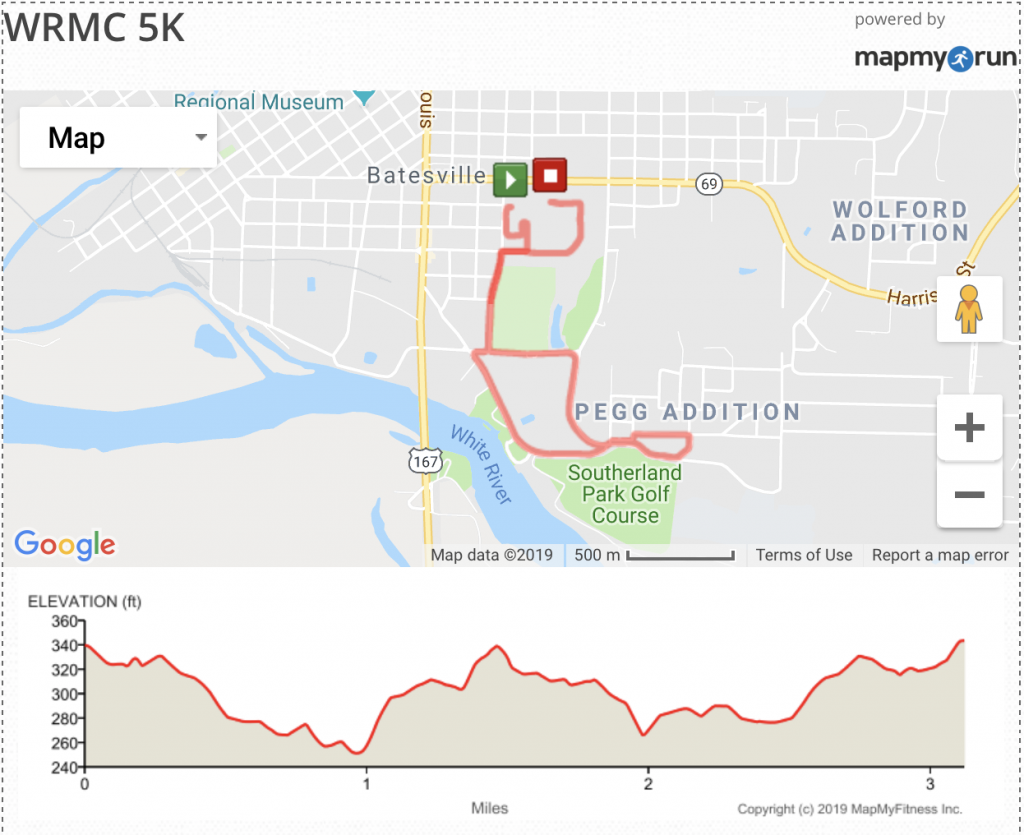
White River Medical Center 5K Route
Route Description: A 5K loop used by the White River Medical Center for their fall race. The Run has a total ascent of 123.13 ft. You can park at the Hospital. The start is at the northern end of the parking lot of the WRMC Professional Building. There is a nail with a washer in the pavement. The finish is in front of the Women’s and Imaging center, basically on the road in front of the glass doors. It is not advisable to run this route during heavy traffic times at the hospital, however weekends or early/late should be fine. Some residential neighborhoods so keep your eyes open for a dog or two. Moderately hilly.
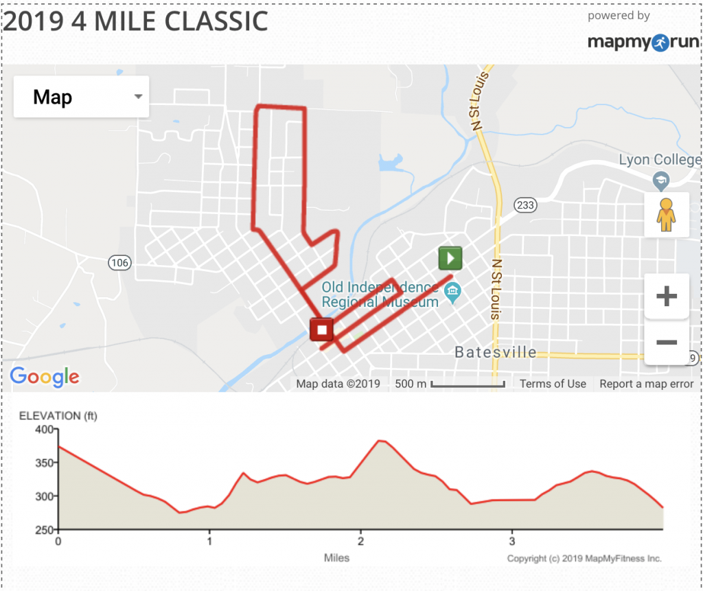
2019 Batesville 4 Mile Classic
Course Description: New in 2019, this course now features less elevation gain than previous courses. The route has a total ascent of 149.22 ft. It still takes in Main and Water streets and ends in Downtown Batesville.
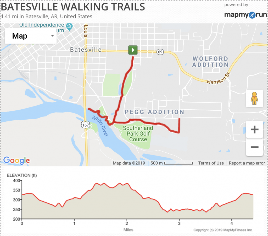
Batesville city trails 4 mile, out and back
Route Description: A 4+ mile Paved or concrete, 6 – 10 foot wide walking trail. Parking at the Hospital, Aquatic Center, Riverside Park or High School. The route has a total ascent of 230.35 ft. Watch for heavy traffic during School hours. One long hill up to the High School and then the infamous High School “Baja”, Batesville’s only approved location for street graffiti.
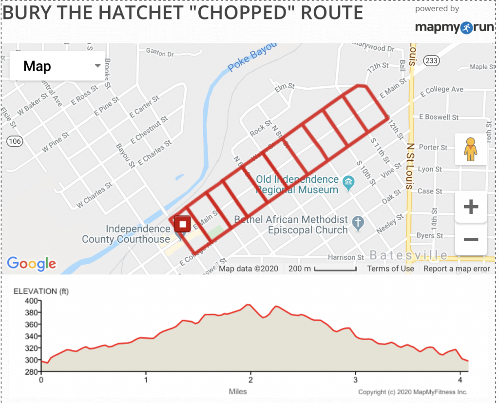
Tomahawk Chop “Bury the Hatchet” chopped course
Route Description: A winding route through quiet downtown neighborhoods, recently ran as our “Bury the Hatchet” run. The constant change in direction guarantees an even tan